
Sankt Peterzell between the Necker and pilgrimage routes
Accommodation in Sankt Peterzell
Sankt Peterzell is a locality in Switzerland. It is located in the canton of St. Gallen and the Toggenburg electoral district. At the same time, Sankt Peterzell is a former political municipality. Since 2009, the locality, together with Brunnadern and Mogelsberg, has formed the municipality of Neckertal. The former political independence and today’s affiliation with the municipality of Neckertal therefore refer to two different administrative situations. The locality lies along the middle section of the Necker. Today, two sections of the Way of St. James meet here. In the 11th century, three pilgrimage routes converged in Sankt Peterzell. Thus, both the location along the river and the historic route network are defining aspects of the locality.
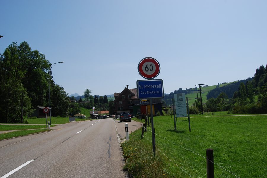 St. Peterzell, municipality of Neckertal, canton of St. Gallen, Switzerland
Photo: Dietrich Michael Weidmann via Wikimedia Commons, CC BY-SA 3.0
St. Peterzell, municipality of Neckertal, canton of St. Gallen, Switzerland
Photo: Dietrich Michael Weidmann via Wikimedia Commons, CC BY-SA 3.0
Landscape and routes
The St. Peterzell Cultural Trail is a moderately difficult 6.1 km hike with a walking time of two hours. The route includes 184 m of ascent and descent. It starts in the village and leads via the hamlet of Hofstetten. It then reaches the hamlet of Furt in Brunnadern. Via Auboden, the route returns to its starting point in St. Peterzell. The cultural trail follows an old pilgrimage route in the Toggenburg holiday region. This route was an important trade route. The trail thus links the village, the two hamlets and Auboden into a circular route. Its distance, walking time, ascent and descent clearly define the scope of the trail.
One hike follows the wild Necker, passes gentle hills and traverses broad, green countryside. At the Rütteli barbecue area in St. Peterzell, the site invites visitors to barbecue, swim in the Necker and linger. The Rütteli barbecue and swimming area is located directly at the confluence of the Tüfenbach and the Necker.
The stated walking time of two hours and the distance of 6.1 kilometres make the extent of the cultural trail easy to assess. Together with the 184 metres of ascent and descent, the route’s changes in elevation are also specified. Its course not only connects St. Peterzell with Hofstetten, Furt in Brunnadern and Auboden, but then returns to the starting point. At Rütteli, the waterways of the Tüfenbach and the Necker meet the stated opportunities for barbecuing, swimming and relaxing.
History and architectural heritage
The origins of the provostry of St. Peterzell date back to the hermitage «Sancti Petri Cella». The provostry building in St. Peterzell was completed in 1764. The building was an important stopping point along the packhorse trail. This packhorse trail connected the monasteries of St. Gallen and St. Johann. The Falksche House in Sankt Peterzell has a Rococo façade.
Local life and transport
The carnival parade in St. Peterzell takes place every other year. Sankt Peterzell is served by three PostBus routes for public transport.
Other places
Additional locality pages lead to Bächli, Stein, Ebnat-Kappel, Nesslau-Krummenau, Mogelsberg, Lichtensteig, Krinau and Mosnang.
To the higher-level travel overview: Toggenburg.

_242.JPG)